Hurricane Dorian was expected to become a “dangerous” storm as it trudges toward Florida after sweeping through the U.S. Virgin Islands on Wednesday, the National Hurricane Center said in its 5 p.m. update.
“Hurricane Dorian is now expected to be a Cat 3 hurricane as it moves ashore along the east coast of Florida early Monday morning,” Fox 35 meteorologist Glenn Richards said Wednesday evening. “This would be the strongest hurricane to hit Central Florida in over 30 years. Hurricane force sustained winds would be carried across the entire width of the state if the current forecast holds.”
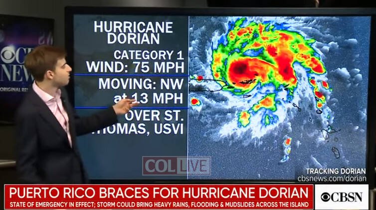
As of 5 p.m’, Dorian was a Category 1 storm with 80 mph winds and was located 45 miles northwest of St. Thomas moving northwest at 14 mph. The storm is expected to grow in size and could hit Category 3 status before reaching Florida’s east coast by late Sunday or early Monday. By Monday afternoon it could still be a Category 2 hurricane as it moves over the Orlando area.
The cone of uncertainty shows it could also be anywhere from coastal Georgia to the southern tip of Florida or west of Florida in the Gulf of Mexico by that time.
Florida Gov. Ron DeSantis on Wednesday evening declared a State of Emergency.
“Today, I am declaring a state of emergency to ensure Florida is fully prepared for Hurricane Dorian,” DeSantis said. “It’s important for Floridians on the East Coast to monitor this storm closely. Every Florida resident should have seven days of supplies, including food, water and medicine, and should have a plan in case of disaster. I will continue to monitor Hurricane Dorian closely with emergency management officials. The state stands ready to support all counties along the coast as they prepare.”
Central Floridians have started preparing for the hurricane, which could hit the area on Monday.