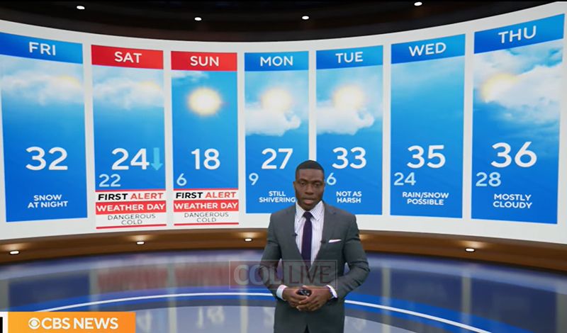
A quick-hitting winter weather system is set to move through the New York City region this weekend, bringing dangerously cold temperatures.
The National Weather Service has placed New York City under an extreme cold watch from Saturday evening through Sunday afternoon as an arctic air mass settles in behind the system.
Forecasters say most of the snowfall will occur overnight into Saturday morning. While overall accumulations are expected to be limited, brief snow squalls could develop, creating sudden drops in visibility and short-lived accumulations on roadways.
Even with some sunshine Friday afternoon, temperatures will struggle to rise, remaining below freezing. Highs are expected to hover around 30 degrees in New York City.
Snow is forecast to begin late Friday night, followed by a sharp plunge in temperatures. Daytime highs are expected to reach only around 20 degrees on Saturday and dip to near 19 degrees on Sunday. Strengthening winds throughout the weekend will intensify the cold.
While snowfall amounts are expected to stay on the lighter side, totals may vary depending on location.
The National Weather Service warned that wind chills could fall well below zero from Saturday into Sunday, with the most severe conditions expected late Saturday night into Sunday morning. Wind chill values could drop to between minus 20 and minus 25 degrees in inland areas, and minus 10 to minus 20 degrees elsewhere.